

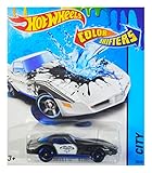
Hot Wheels 2016 Color Shifters, '82 Corvette Stingray Police Car (Black to White)
Appliances
Arts, Crafts & Sewing
Automotive
Baby
Beauty
Books
CDs & Vinyl
Collectibles & Fine Arts
Cell Phones & Accessories
Clothing, Shoes & Jewellery
Computers
Electronics
Health & Personal Care
Home & Kitchen
Industrial & Scientific
Luggage & Travel Gear
Musical Instruments
Office Products
Patio, Lawn & Garden
Pet Supplies
Software
Sports & Outdoors
Tools & Home Improvement
Toys
Video Games


![AMILIFECASES Magnetic Compatible with iPhone 15 Case, [Built-in Invisible Kickstand][Compatible with MagSafe][Full Camera Protection] Translucent Matte Phone Case for iPhone 15 6.1](https://m.media-amazon.com/images/I/41EChqvpg7L._SL160_.jpg)
![AuroiCCY Magnetic Case for iPhone 15 with Holder Stand, [Compatible with Magsafe] Bling Glitter Diamonds Rhinestone Camera Lens Protector for Woman Girly Cute Phone Cover for iPhone 15 6.1](https://m.media-amazon.com/images/I/51J-x6usMlL._SL160_.jpg)
