

Antarctic Continent Waterproof Exploration Map 1:6.8M
Product Description
Antarctic Continent Waterproof Exploration Map 1:6.8M
102 x 72 cm - 1:6800000 - All in one side - 80 gram - ANTARCTIC CONTINENT EXPLORATION MAP - Penetration Routes, Discovery Ships, Human Presence in Antarctica
Detailed map including the historical approaches and penetration routes to the White Continent. Sites and stations. Gravures of old ships.
Detallado mapa que incluye los derroteros de aproximacion y las rutas de penetracion al Continente Blanco. Asentamientos y bases. Grabados de barcos historicos.
Technical Specifications
You might also like

Antarctic Explorer Map; (Ocean Explorer Maps)

Lonely Planet Antarctica (Travel Guide)

Antarctic Wildlife: A Folding Pocket Guide to Familiar Species of the Antarctic and Subantarctic Environments (Wildlife and Nature Identification)

Antarctica Cruising Guide: Fourth edition: Includes Antarctic Peninsula, Falkland Islands, South Georgia and Ross Sea
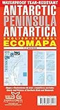
Antarctic Peninsula Antartica - Ecomapa (English/Spanish Edition)

Antarctica: A Guide to the Wildlife (Bradt Travel Guide)

Antarctic Wildlife: A Visitor's Guide (Princeton University Press (Wildguides))

Antarctica: An Intimate Portrait of a Mysterious Continent

Antarctica Map Guide