

Arizona Topographic Recreational Map
Product Description
Arizona Topographic Recreational Map
Topographic full color Arizona state map is scaled at 1" = 12.5 miles. Elevation contours each 1,000 feet (color shaded each 2,000 feet at higher elevations) portray the general geography. Old Route 66 is highlighted in yellow. Also shown are national forests, wilderness areas, campgrounds, parks, state game and fish areas, ski areas, mining districts, points of interest, and more. More roads are shown than on typical highway maps. Much printed information is also included.
Technical Specifications
You might also like

Nevada Topographic Recreational Map GTR

Topographic recreational map of Utah

Topographic Recreational Map of Colorado

Topographic Recreational Map of New Mexico: Detailed Travel Map

Arizona Easy to Read

Arizona Benchmark Road & Recreation Atlas
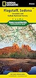
Flagstaff, Sedona [Coconino and Kaibab National Forests] (National Geographic Trails Illustrated Map)

Arizona Recreation Map

Arizona Atlas & Gazetteer

Rand Mcnally EasyFinder Arizona (Map)