
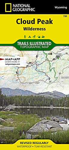
Cloud Peak Wilderness Map (National Geographic Trails Illustrated Map, 720)
Product Description
Cloud Peak Wilderness Map (National Geographic Trails Illustrated Map, 720)
Coverage includes Bighorn National Forest, Highland Park, Meadowlark Lake, Kearny Lake Reservoir, Coffeen Park. Includes UTM grids for use with your GPS unit.
- Folded Size = 4.25 x 9.25
- Sheet Size = 37.75 x 25.5
- Scale = 1:45,000
Technical Specifications
Customers who bought this also bought


You might also like

Hiking Wyoming's Cloud Peak Wilderness (Regional Hiking Series)

Hiking Wyoming's Bighorn Mountains: A Guide to the Area's Greatest Hiking Adventures (Regional Hiking Series)

Black Hills National Forest [Map Pack Bundle] (National Geographic Trails Illustrated Map)

Hiking Wyoming: 110 Of The State's Best Hiking Adventures (State Hiking Guides Series)

Badlands National Park: South Dakota, USA Outdoor Recreation Map (National Geographic Maps: Trails I

Absaroka-Beartooth Wilderness East [Cooke City, Red Lodge] (National Geographic Trails Illustrated Map)
Yellowstone National Park (National Geographic Trails Illustrated Map)
Grand Teton National Park (National Geographic Trails Illustrated Map)

Wyoming Atlas & Gazetteer