

Flagstaff Trails Map
Product Description
Flagstaff Trails Map
The Flagstaff Trails Map depicts more than 300 miles of hiking, biking, and equestrian trails and 56 miles of Flagstaff Urban Trails System (FUTS) trails in a 375-square mile area around Flagstaff, Arizona. Features include easy-to-read shaded topography, trail mileage, summary information for 71 trails shown on the map, vertical profiles for 49 trails, and lat-long coordinates for GPS users. Other information includes campgrounds, picnic areas, trailheads, wilderness areas, landmarks, watchable wildlife sites, and scenic views. Printed two sides in full color on durable, waterproof, tear-resistant synthetic paper. Unfolded size is 24 x 37 inches; folds down to 4 x 7.75 inches. The scale is 1:35,000.
Technical Specifications
You might also like

Sedona Trails Map (English and Japanese Edition)
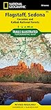
Flagstaff/Sedona, Coconino National Forest (Trails Illustrated Map # 856) (National Geographic Trails Illustrated Map)

Flagstaff & Sedona: 50 Favorite Hikes

Five-Star Trails: Flagstaff and Sedona: Your Guide to the Area's Most Beautiful Hikes
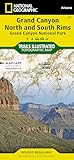
Grand Canyon, North and South Rims [Grand Canyon National Park] (National Geographic Trails Illustrated Map)
Grand Canyon Trail Map 5th Edition

Great Sedona Hikes Revised Fourth Edition: Fourth Edition (Volume 4)

Mountain Biking Arizona Trail Guide: Fat Tire Tales & Trails