

Folded Map: New England
Product Description
Folded Map: New England
Rand McNally's folded map featuring New England is a must-have for anyone traveling in and around this part of the country, offering unbeatable accuracy and reliability at a great price. Our trusted cartography shows all Interstate, state, and county highways, along with clearly indicated points of interest, airports, county boundaries, and more.
You'll see why Rand McNally folded maps have been the trusted standard for years.
Regularly updated, full-color maps
Clearly labeled Interstate, U.S., state, and county highways
Detail maps of major cities, a mileage chart, and a Mileages & Driving Times Map
Indications of parks, points of interest, airports, county boundaries, and more
Easy-to-use legend
Detailed index
Convenient folded size
Coverage Area
Detailed maps of: Bridgeport, CT; Hartford, CT; New Haven, CT; Boston & Vicinity, MA; Boston Downtown, MA; Springfield, MA; Worcester, MA; Bangor, ME; Lewiston, ME; Portland, ME; Concord, NH; Manchester, NH; Nashua, NH; Newport, RI; Providence, RI; Burlin
Product Details
Measures 9.5" x 4.125" and folds out to 40" x 28".
Technical Specifications
You might also like

Lonely Planet New England's Best Trips (Travel Guide)

Fodor's New England: with the Best Fall Foliage Drives & Scenic Road Trips (Full-color Travel Guide)

Easy To Read: New Hampshire, Vermont (Rand McNally Easy to Read!)

Massachusetts State Map

Fodor's Maine, Vermont, & New Hampshire: With the Best Fall Foliage Drives & Scenic Road Trips (Full-color Travel Guide)

Easy To Read: Connecticut, Rhode Island (Rand McNally Easy to Read!)
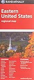
Folded Map: Eastern United States

Easy To Read: New York State Map (Rand McNally Easy to Read!)

Frommer's New England (Complete Guides)