

Rand McNally Streets of O'ahu Honolulu
Product Description
Rand McNally Streets of O'ahu Honolulu
Rand McNally's folded map featuring the streets of O'ahu and Honolulu is a must-have for anyone traveling in and around Hawai'i, offering unbeatable accuracy and reliability at a great price. Our trusted cartography shows all Interstate, U.S., state, and county highways, along with many smaller roads and streets, too.
You'll see why Rand McNally folded maps have been the trusted standard for years.
Regularly updated, full-color maps
Clearly labeled Interstate, U.S., state, and county highways
One-way streets indicated
Indications of county boundaries, schools, shopping malls, parks, golf courses, hospitals, airports, and points of interest
Easy-to-use legend
Detailed street index
Compact folded size
Coverage Area
Communities include: 'Aiea, 'Ewa Beach, Halawa Heights, Kahalu'u, Kailua, Kane'ohe, Makakilo City, Mililani, Pacific Palisades, Pearl City, Waikiki, Waimanalo, Whitmore Village
Product Details
Measures 9.5" x 4" and folds out to 40" x 28"
Technical Specifications
You might also like

Fodor's Oahu: with Honolulu, Waikiki & the North Shore (Full-color Travel Guide)

Map of O'ahu: The Gathering Place (Reference Maps of the Islands of Hawai'i)
Oahu Revealed: The Ultimate Guide to Honolulu, Waikiki & Beyond

Honolulu, Oahu Hawaii MAP (English, French and German Edition)

Hawaii (National Geographic Adventure Map)

Oahu Revealed: The Ultimate Guide to Honolulu, Waikiki & Beyond
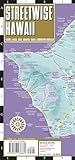
Streetwise Hawaii Map: Laminated Hawaii, Kauai, Maui, Molokai, Oahu & Downtown Honolulu (Michelin Streetwise Maps)

Hawaii The Big Island Adventure Guide Franko Maps Waterproof Map

Frommer's Honolulu and Oahu day by day (Day by Day Guides)

Rand McNally Folded Map: Charlotte Street Map