

Humminbird 600047-2 SmartStrike Mid-Atlantic V2 Digital GPS Maps Micro Card , Black
Product Description
Humminbird 600047-2 SmartStrike Mid-Atlantic V2 Digital GPS Maps Micro Card , Black
- SmartStrike takes you straight to the action by showing you where the fish should be biting at any given moment.
- Based on search parameters like season, time of day, temperature and targeted fish species, SmartStrike highlights areas of the lake map where your prey is most likely to be located - before you even wet a line.
- Includes all lake maps found on the current Mid-AtlanticLakeMaster card.
- Includes highly requested water bodies such as - Anna, Falls Lake, Greenwood Lake, Hartwell, Hickory, Keowee, Jocassee, Stonewall Jackson Lake and more.
- LakeMaster SD/micro cards include features such as Depth Highlight, Shallow Water Highlight and Water Level Offset, which can be used exclusively with Humminbird fish finders
- Can be used with Minn Kota i-Pilot Link, allowing you to “Follow” a selected depth contour line, delivering precise, automatic boat control
- Scrollable lake list allows you to view and research lakes from your Humminbird fish finder on and off the water
- SmartStrike full search functionality is exclusive to High-Definition waters only and GPS-equipped APEX, SOLIX, HELIX, ONIX and ION units.
- Opened packages are not eligible for return.
- 30-Day Cartography Warranty
Combining high-definition LakeMaster lake map data with extensive search algorithms, Humminbird SmartStrike takes you straight to the action by showing you where the fish should be biting at any given moment. Based on search parameters like season, time of day, temperature, and targeted fish species, SmartStrike highlights areas of the lake map where your fish are most likely to be located before you even wet a line. LakeMaster digital maps provide the most detailed, high-definition collection of freshwater mapping in the United States, with unmatched depth contours between 1-3 feet (in high definition) or 3-5 feet (standard definition). This SmartStrike Mid-Atlantic States Edition, Version 2 boasts more than 45 high-definition lakes and over 170 total lakes from SC, NC, VA, WV, MA, and DE. (SmartStrike available only for high-definition lakes.) It Includes highly-requested water bodies such as Anna, Falls Lake, Greenwood Lake, Hartwell, Hickory, Keowee, Jocassee, Stonewall Jackson Lake, and more. SmartStrike includes such LakeMaster features as selecting a particular depth range, adjustable highlighting of shallow-water areas up to 30 feet, and synchronizing depth contours and shorelines with the actual water level of lakes, reservoirs, and rivers. SmartStrike can be used with Minn Kota i-Pilot Link (sold separately), allowing you to follow a selected depth contour line to deliver precise, automatic boat control. Collected by Humminbird's own team of GIS analyst cartographers, LakeMaster high-definition maps are created from on-the-water surveys using hundreds of thousands of depth soundings plus state-of-the-art GPS and sonar technologies. SmartStrike digital maps come on a Micro SD card (with included SD card adapter) that's compatible with all GPS-equipped HELIX, SOLIX, ONIX, and ION Series models and select 600-1100 Series models. Strictly intended for use in your Humminbird GPS unit, SmartStrike mapping cards are not PC compatible and map files could be corrupted if accessed on a computer.
Technical Specifications
You might also like

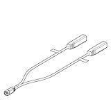
Humminbird 720074-1 AS EC QDE 700 Series Ethernet Adapter Cable
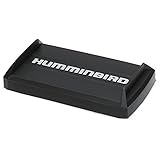
Humminbird 780036-1 Humminbird 780036-1 UC H7 PR Unit Cover for Helix 7 Fishfinder Models

RAM Drill-Down Double Ball Mount for Humminbird Helix 7
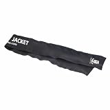
T-H Marine GFTJ-1-DP G-Force Jacket Trolling Motor Cable Organizer Sleeve

Humminbird SmartStrike Southeast States Edition Digital GPS Lake Maps, Micro SD Card, Version 4
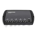
Humminbird 408450-1 5 Port Ethernet Switch

Minn Kota Precision Digital Chrgr MK 440 PC 4 bank x 10 amps

MinnKota US2 Adaptor Cable for Humminbird 7 Pin
Humminbird 720101-1 Humminbird 720101-1 9 M SIDB Y 9-Pin Side Imaging Dual Beam Splitter Cable

Humminbird Helix 9 G3N Fish Finder with Chirp, MEGA SI+, GPS, and 9-Inch-Display