

Outdoor Trail Maps LLC Lost Creek Wilderness - Colorado Topographic Hiking Map (2022)
Product Description
Outdoor Trail Maps LLC Lost Creek Wilderness - Colorado Topographic Hiking Map (2022)
- Waterproof, tear-resistant, 1:48,000 scale with a compact 4"x7" folded size for your pocket
- Smaller and lighter - no more unfurling huge maps - designed for on-trail use
- Segment distances - mileage - for all trails
- Updated for 2022 with accurate trail routings and distances
- GPS coordinates for trailheads and trail junctions - device compatible
Waterproof, tear-resistant topographic hiking map covering all of the hiking trails in the Lost Creek Wilderness of Colorado just southwest of Denver, including the Kenosha Mountains, Platte River Mountains and Puma Hills. The front side of the map covers the western portion of the wilderness, including the Ben Tyler Trail, Craig Creek Trail, the Brookside-McCurdy Trail, etc just south of Bailey, CO. The back of the map shows the eastern and southern portion of the wilderness including the Hankins Pass area, Goose Creek and Lost Park hiking loops, among others.
Technical Specifications
You might also like
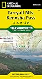
Tarryall Mountains, Kenosha Pass (National Geographic Trails Illustrated Map)

Collegiate Peaks Wilderness - Colorado Topographic Hiking Map (2018)

Maroon Bells-Snowmass Wilderness - Colorado Topographic Hiking Map (2018)

Colorado's Lost Creek Wilderness: Classic Summit Hikes

Weminuche Wilderness (National Geographic Trails Illustrated Map)

Therm-a-Rest Z Seat SOL Cushion, Limon/Silver

Nemo Fillo Inflatable Travel Pillow with Fabric Cover

Hiking Colorado's Weminuche and South San Juan Wilderness Areas: A Guide to the Area's Greatest Hiking Adventures (Regional Hiking Series)

Osprey UltraLight Raincover, Shadow Grey, Medium