

Map of UK and Ireland
Product ID: 0721709389
Condition: New
Payflex: Pay in 4 interest-free payments of R445.00. Read the FAQ
R 1,780
includes Duties & VAT
Delivery: 10-20 working days
Ships from USA warehouse.
Secure Transaction
VISA
Mastercard
payflex
ozow

Product Description
Map of UK and Ireland
- New
- Mint Condition
- Dispatch same day for order received before 12 noon
- Guaranteed packaging
- No quibbles returns
This detailed relief map of the United Kingdom and Ireland is colour coded to show the area of each country and large city. County boundaries are marked, as are rivers, motorways, ports and airports. An explanation of the political relationship between the countries is given, alongside information about the distance from sea level to Ben Nevis.
Technical Specifications
Country
USA
Brand
Schofield & Sims
Manufacturer
Schofield & Sims Ltd
Binding
Map
Height
30.3149
Length
20.8661
Weight
2.314853751
Width
0.019685
You might also like
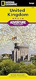
United Kingdom (National Geographic Adventure Map)

48x78 Huge United States, USA Classic Elite Wall Map Laminated

Britain and Ireland Classic [Laminated] (National Geographic Reference Map)

England Flag 3'x5'Brand NEW 3x5 ENGLISH ST GEORGE CROSS

British Union Jack (UK Great Britain) Country Flag: 3x5ft poly