

Maps International Large Asia Wall Map (Political) - Paper
Product Description
Maps International Large Asia Wall Map (Political) - Paper
- Size: 35.91 x 29.92 inches
- Your map is printed onto 110 gsm paper and is left unfinished.
Maps International's large political wall map of Asia shows all countries from Turkey in the West to Japan in the East, down to Indonesia in the South of Asia. The largest and most populated continent, Asia has a lot to fit onto a map! Rest assured though, with Maps International's high quality of mapping nothing is missed out!Map Details: This political wall map of Asia features countries marked in different colors, with international borders clearly shown. The map's key shows the flags from the countries displayed in this map. This Asia political wall map also contains city population detail, capital cities and all the major towns and cities in this continent of Asia. Map uses: As with most of our maps, the Asia political wall map, is available in a range of finishes from paper and laminated to wooden style frames. This Large size is ideal for an office or classroom. This Large Asia Wall Map (political) is offered in a range of finishes - choose from the variation options above.
Technical Specifications
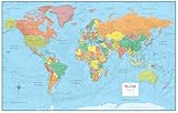
You might also like

Maps International Europe Wall Map (Laminated)

Maps International Africa Wall Map (Laminated)

Extra Large Europe Wall Map (political) - Laminated

Maps International North America Wall Map (Laminated)

Extra Large Middle East Wall Map (political) - Laminated

Rand McNally M-Series Full-Color Laminated United States Wall Map, 50 x 32 Inches (RM528960911)

48x78 Huge United States, USA Classic Elite Wall Map Laminated
48x78 World Classic Premier Wall Map Mega Poster (48x78 PAPER)

Painless Learning Asia Map Placemat