

Mid-Atlantic Lighthouses Illustrated Map & Guide: New Jersey, Delaware, Se Pennsylvania, Maryland & Virginia
Product Description
Mid-Atlantic Lighthouses Illustrated Map & Guide: New Jersey, Delaware, Se Pennsylvania, Maryland & Virginia
- Used Book in Good Condition
★ All 71 standing and 103 "lost" lighthouses in New Jersey, Southeast Pennsylvania, Delaware, Maryland & Virginia located on a detailed map.
★ History and description of each standing lighthouse.
★ Directions to every standing light or the best viewing spots.
★ Listing of lighthouse & maritime museums.
★ Directory of lighthouse cruises, ferries & sightseeing flights.
★ True Tales of Mid-Atlantic lighthouses.
★ 29 original watercolor illustrations.
★ Printed on paper, two sides.
★ Size: 24x36 inches, folded to 4x9 inches
For laminated poster version, enter 1888216352 in search box.
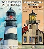
Similar maps available for Maine, Massachusetts & Rhode Island, Southeast (NC, SC & GA), Florida, California & Hawaii, and Northwest (OR, WA & AK); plus U.S. Lighthouses map & directory. Search "Bella Terra Publishing" on amazon.com to find them all.
Technical Specifications
You might also like

Southeast Lighthouses Illustrated Map & Guide: North Carolina, South Carolina & Georgia

United States Lighthouses: Illustrated Map & Guide

Lighthouses of Maryland and Virginia
Pacific Coast Lighthouses Map Pack - California, Oregon, Washington, Alaska & Hawaii

Florida Lighthouses Illustrated Map & Guide

Maine Lighthouses Illustrated Map & Guide

Lighthouses of America