

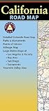
Easy To Read: California State Map
Product Description
Easy To Read: California State Map
- Used Book in Good Condition
Rand McNally's Easy To Read State Folded Map is a must-have for anyone traveling in and around California, offering unbeatable accuracy and reliability at a great price. Our trusted cartography shows all Interstate, U.S., state, and county highways, along with clearly indicated parks, points of interest, airports, county boundaries, and streets.
The easy-to-use legend and detailed index make for quick and easy location of destinations. You'll see why Rand McNally folded maps have been the trusted standard for years.
Regularly updated, full-color maps
40% larger map with a bigger type size than the Rand McNally Folded Map
Clearly labeled Interstate, U.S., state, and county highways
Indications of parks, points of interest, airports, county boundaries, and more
Mileage and driving times map
Detailed index
Convenient folded size
Coverage Area
Detailed maps of: Bakersfield, Fresno, Joshua Tree National Park, Kings Canyon Natl Park & Sequoia Natl Park, Lake Tahoe Region, Lancaster/Palmdale, Los Angeles, Modesto, Monterey/Salinas, Oceanside, Oxnard/Ventura, Palm Springs, Sacramento, San Diego
Technical Specifications
You might also like

Easy To Read: Washington State Map

Easy To Read: Oregon State Map (Rand McNally Easy to Read!)

Easy To Read: Arizona State Map
Folded Map: Western United States
Utah Road Map

Rand McNally Folded Map: Nevada

Rand McNally Folded Map: Los Angeles Street Map
Benchmark California Road Map
Moon Pacific Coast Highway Road Trip: California, Oregon & Washington (Travel Guide)

Easy To Read: Texas State Map (Rand McNally Easy to Read!)