
Rand McNally Folded Map: Fort Lauderdale Metro Street Map
Product Description
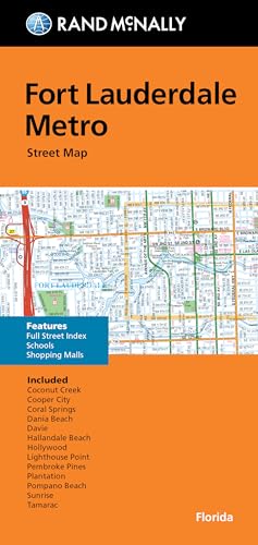
Rand McNally Folded Map: Fort Lauderdale Metro Street Map
- Used Book in Good Condition
Rand McNally's folded map for Fort Lauderdale Metro is a must-have for anyone traveling in and around this part of Florida, offering unbeatable accuracy and reliability at a great price. Our trusted cartography shows all Interstate, U.S., state, and county highways, along with clearly indicated parks, points of interest, airports, county boundaries, and streets. The easy-to-use legend and detailed index make for quick and easy location of destinations. You'll see why Rand McNally folded maps have been the trusted standard for years.
Regularly updated
Full-color maps
Clearly labeled Interstate, U.S., state, and county highways
Indications of parks, points of interest, airports, county boundaries, schools, shopping malls, downtown & vicinity maps
Easy-to-use legend
Detailed index & full street index
Convenient folded size
© 2013
Communities Included: Coconut Creek, Cooper City, Coral Springs, Dania Beah, Davie, Hallandale Beach, Hollywood, Lighthouse Point, Pembroke Pines, Plantation, Pompano Beach, Sunrise, Tamarac
Technical Specifications
You might also like

Rand McNally Folded Map: Miami, Fort Lauderdale, and West Palm Beach Regional Map (Rand McNally Miami/Fort Lauderdale/West Palm Beach)

Rand McNally: Miami Street Map (Rand Mcnally Street Map)

Fort Lauderdale, FL City Street Map

Rand McNally Easy To Read: Florida State Map

Rand Mcnally Folded Map: Orlando Street Map

Fodor's South Florida 2015: with Miami, Fort Lauderdale & the Keys (Full-color Travel Guide)

Rand McNally: Folded Map: Jacksonville Street Map