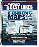
Southeast Michigan Fishing Map Guide
Product Description
Southeast Michigan Fishing Map Guide
- Used Book in Good Condition
Fishing maps, detailed area road maps and exhaustive fishing information are provided in this handy, 240-page, 8 ½ x 11 spiral-bound volume.
Lake maps and fishing information for 220 lakes and streams in Clinton, Genesee, Hillsdall, Ingham, Jackson, Lapeer, Lenawee, Livingston, Macomb, Oakland, St. Clair, Washtenaw, and Wayne counties, plus Lake Erie, Detroit & St. Clair Rivers.
Whether you re trolling for walleyes on Lake St. Clair, jigging for perch on Lake Erie, pitching plastic worms for bass on Lake Orion or exploring the little lakes of the Pinckney Recreation Area, you'll find all the information you need to enjoy a successful day out on the water on one of Michigan s many excellent fisheries.
Know your waters. Catch more fish with the Michigan Southeast Region Fishing Map Guide.