
Superstition Wilderness,

Product Description
Superstition Wilderness,
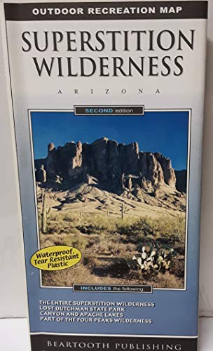
Beartooth Publishing Superstition Wilderness Outdoor Recreation Map is a topographic, shaded relief trail map for campers, hikers, backpackers, equestrians, mountain bikers, 4WDers, and 2WDers. The Superstition Wilderness, just outside of Phoenix, is a hiker's and backpacker's paradise, containing everything from desert canyons with haunting cliffs and spires to pine covered mountains. The contrast of desolate canyons and lush oasises of creeks, springs, and cottonwoods is staggering. This map shows the entire Superstition Wilderness at a detailed 50 foot contour interval - an essential feature for hikers and backpackers. It also includes the entire Four Peaks Wilderness, Lost Dutchman State Park, Tonto National Monument, and Saguaro, Canyon, Apache, and Theodore Roosevelt Lakes. The legend features divided US highways; divided state highways; primary highways; primary public access other paved roads; public assess 2WD improved dirt roads; public access 4WD unimproved dirt roads; residential, private, or forest recreation site, paved or dirt secondary roads; hikers only non-motorized trails; hikers and equestrians only non-motorized trails; hikers, equestrians, and mountain bikers only non-motorized trails; non-maintained unofficial secondary trails; trail mileage markers; Arizona Trail, forest service roads; forest service trails; trailheads; ranger stations; campgrounds; picnic areas; visitor information centers; Apache Trail rest stops; river put-ins and take-outs; boat launches; gates; national monument or state park boundaries; national forest boundaries; national forest ranger district boundaries; wilderness boundaries; and county boundaries. Waterproof, two-sided folded map. Contour Interval = 50' Size:folded = 4.25" x 8" Unfolded = 25" x 39"
Technical Specifications
You might also like

Hikers Guide to the Superstition Wilderness: With History and Legends of Arizona's Lost Dutchman Gold Mine (Hiking & Biking)

Superstition and Four Peaks Wilderness Areas [Tonto National Forest] (National Geographic Trails Illustrated Map)

Superstition Wilderness Trails West: Hikes, Horse Rides, and History

Apache Junction and the Superstition Mountains (AZ) (Images of America)