

The Kearsarge Pass Map
Product Description
The Kearsarge Pass Map
Waterproof, tear resistant shaded relief Topographic map scaled 1:42240 or 1 inch representing 2/3 miles (or better put, 1.5 inches representing 1 mile.) Contour interval 80 feet. GPS Compatible and complete UTM Grid.
Major feature is the Kearsage Pass-Rae Lake Loop, but also covered is the Paradise Valley, Vidette Meadow, Charlotte Lake, Onion Valley and Bubbs Creek. Lst revised in June 2014.
Technical Specifications
You might also like

Kings Canyon High Country Trail Map (Tom Harrison Maps)

Mt. Whitney High CountryTrail Map (Tom Harrison Maps)

Bishop Pass Trail Map (CA) (Tom Harrison Maps)

Mono Divide high country trail map (Tom Harrison Maps)

Sequoia & Kings Canyon National parks recreation map (Tom Harrison Maps)

Sequoia and Kings Canyon National Parks (National Geographic Trails Illustrated Map)

Golden Trout Wilderness Trail Map: Shaded-Relief Topo Map (Tom Harrison Maps)
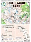
John Muir Trail Map-Pack: Shaded Relief Topo Maps (Tom Harrison Maps)

Palisades Trail Map (Tom Harrison Maps)

Mammoth high country trail map: Waterproof, tearproof (Tom Harrison Maps)