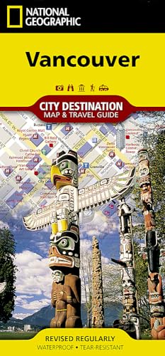
Vancouver Map (National Geographic Destination City Map)
Description
- Waterproof
- Tear-resistant
- travel map
National Geographic's City Destination map of Vancouver is both a comprehensive map and travel guide for this extraordinarily beautiful city. A regional map, insets of Victoria and Granville Island, and information about the city, points of interest, Stanley Park, and Victoria and Vancouver Island are featured on the front side of the map. Individual maps of the Translink System and Vancouver International Airport will help you navigate the transit terminals to more quickly and efficiently access your desired destinations.
A detailed street map of the city is shown on the reverse side, complete with an inset map of the Lower Mainland. Points of interest, theaters, monuments, hotels, churches, parks, visitor information centers, and pedestrian areas are clearly marked and easy to find with the multi-language legend. The location of SkyTrain (light rail), West Coast Express (regional train), and Seabus stations, as well as parking areas are particularly useful in exploring Vancouver and its environs.
Every Destination Map is printed on durable synthetic paper, making them waterproof, tear-resistant and tough — capable of withstanding the rigors of any kind of travel.
- Map Scale = 1:13,700
- Sheet Size = 17.75" x 24.75"
- Folded Size = 4" x 8.75"
Technical Specifications
Shipping & Delivery
Your order is shipped from the USA and delivered to your door in South Africa in 10–20 working days. All items are fully tracked.
Returns & Exchanges
We offer a 30-day return window. If something isn't right, contact our support team and we'll make it right.