

Wyoming Topographic Recreational Map
Product Description
Wyoming Topographic Recreational Map
This topographic full color folded map of the State of Wyoming is scaled at 1" = 12.5 miles. Elevation contours each 1,000 feet (color shaded each 2,000 feet at higher elevations) portray the general geography. Also shown are national forests, wilderness areas, campgrounds, parks, state game and fish areas, ski areas, mining districts, points of interest, & MORE! More roads are shown than on typical highway maps, plus a cornicopia of printed recretional information is also included.
Paper, self-cover, two-sided folding map.
Scale = 1:792,000
Size: * Folded = 4-1/4" x 9"
* Unfolded = 37" x 24"
Technical Specifications
You might also like

Western Montana Topographic Recreational Map

Topographic Recreational Map of Colorado

Topographic Recreational Map of Western Montana

Topographic recreational map of Utah

Wyoming Recreation Map

Topographic recreational map of Idaho

New Mexico Receational Map GTR

DeLorme® Wyoming Atlas & Gazetteer (Delorme Atlas & Gazeteer)
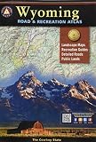
Wyoming Road & Recreation Atlas: 3rd Edition