

Indian Peaks - James Peak Wilderness - Colorado Topographic Hiking Map (2021)
Product Description
Indian Peaks - James Peak Wilderness - Colorado Topographic Hiking Map (2021)
- Waterproof, tear-resistant, 1:48,000 scale with a compact 4"x7" folded size for your pocket
- Smaller and lighter - no more unfurling huge maps - designed for on-trail use
- Segment distances - mileage - for all trails
- Updated for 2018 with accurate trail routings and distances
- GPS coordinates for trailheads and trail junctions - device compatible
Waterproof, tear-resistant topographic hiking map covering all of the hiking trails in the James Peak and Indian Peaks wilderness areas of Colorado and the surrounding areas. The front side of the map - the south side - covers the James Peak Wilderness as well as the Winter Park area and trails west of Rollinsville. The back of the map shows Indian Peaks Wilderness including the Brainard Lake Recreation Area, Mount Audubon, Middle Saint Vrain area and Saint Vrain Mountain.
Technical Specifications
You might also like

Rocky Mountain National Park Hiking Map

Lost Creek Wilderness - Colorado Topographic Hiking Map (2018)

Maroon Bells-Snowmass Wilderness - Colorado Topographic Hiking Map (2018)

Best Hikes Colorado's Indian Peaks Wilderness: A Guide to the Area's Greatest Hiking Adventures (Regional Hiking Series)

Rocky Mountain National Park - 2018 Topographic Hiking Map

Southern Rocky Mountain National Park & Indian Peaks Wilderness Trail Map, 4th Edition
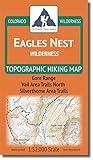
Eagles Nest Wilderness - Colorado Topographic Hiking Map (2018)

Indian Peaks, Gold Hill (National Geographic Trails Illustrated Map)